The direct answer
Almost every expensive mistake on a new Ugandan farm is a position mistake, not a construction mistake. The store is well built but sits where the lorry cannot reach it in April. The house is sound but sits downwind of the animal shed. The first crop block is in the best soil on the farm, which is exactly where the access track now has to cross.
Layout planning prevents that, and it costs nothing except discipline before the first trench is dug. It has three stages, in this order and no other:
- Survey the site before you decide anything. Walk it, record it, and draw it. You cannot zone land you have not measured.
- Zone by function, working outward from the dwelling. FAO's farmstead planning method places family living at the centre and arranges other functions in concentric zones around it, so that traffic, odour, dust and noise move away from where people live rather than through it.
- Phase construction so that each stage leaves the next one possible. The test for every phase is not "can I afford it" but "does this block anything I will want in five years".
Two things are fixed before all others and are almost impossible to move later: the access route and the water point. Everything else is arranged around them.
One legal point must be settled before you build. Under Uganda's Physical Planning Act, 2010, the whole country is a planning area and development permission is required for building work. That is not optional and it is covered below.
Who this article is for
You are setting up a new farm, or restructuring one that grew without a plan. You have secured the land, or you are about to. You have an idea of what you want to produce but the site is still mostly empty, or mostly bush.
You are a farm manager, an owner, an investor assessing whether a site can support the plan proposed for it, or a student learning how the decision is actually made.
You do not need to have chosen your enterprises yet. In fact this article works better if you have not, because the layout question and the enterprise question inform each other. Falcon's article on choosing a farm enterprise handles the second half of that conversation.
The problem this solves
Ugandan farms are shaped by three conditions that make layout errors permanent.
Holdings are small and fragmented. The Uganda Bureau of Statistics Annual Agricultural Survey 2020 reports that the average operated parcel size in the country is 0.6 hectares and each household operated two parcels on average per season, with a national average total landholding of 1.2 hectares. Roughly 40 percent of agricultural households hold less than 0.5 hectares and only 13 percent hold over 2.0 hectares. On a holding of that size there is no spare ground to correct a badly placed building.
Slope is common and unforgiving. Placing a structure, a track or a water line across a slope without thinking about runoff turns the whole layout into a drainage problem in the first heavy season.
Access decides everything commercial. A farm that cannot get produce out in the wet season is a farm with two selling windows a year instead of continuous ones.
The result is that layout is not a cosmetic decision. It sets the cost of every future movement of people, water, inputs and produce for the life of the farm.
The decision you are making
By the end of this article you should be able to draw a single sheet showing, for your actual site:
- Where the dwelling and the family living zone sit.
- Where the water point sits and where water is stored.
- Where the vehicle can reach, turn and load, in all weather.
- Where crop blocks sit, and their orientation.
- Where livestock housing sits relative to the dwelling and the prevailing wind.
- Where the compost area, the store and the workshop sit.
- Which land is deliberately left undeveloped, and why.
- What gets built in phase 1, phase 2 and phase 3, and what must not be blocked by any of them.
That single sheet is the deliverable. Everything below produces it.
Uganda-specific context
Physical planning permission applies to the whole country. The Physical Planning Act, 2010, section 3, states that "The entire country is declared a planning area and this Act shall apply to the entire country in all respects." Section 33(1) states that "A person shall not carry out a development within a planning area without obtaining development permission from a physical planning committee." The Act's section 2 defines development to include "the making of any material change in the use or density of any buildings or land or the subdivision of any land" and "the erection of such buildings or works and the carrying out of such building operations". Section 33(2) makes contravention an offence.
In plain terms: erecting farm buildings, and subdividing land, are development. Ask your district or municipal physical planning office what is required for your specific works before you build, not after.
Water bodies carry protected zones. The National Environment Management Authority states that a lakeshore is "the land not more than 100 metres adjacent to or bordering a lake" and a river bank is "the rising ground, not more than 100 metres long, bordering, or adjacent to the natural course of a river", and that the penalty for offences in this area can reach "a fine not exceeding thirty thousand currency points or imprisonment not exceeding twelve years or both". If any part of your site is near a river, a lake or a wetland, treat that edge as regulated land and get the position confirmed by NEMA or your district environment officer before you place anything there.
Falcon has not verified the numbered regulation behind the 100 metre figures and does not state one. The distances above are quoted from NEMA's own published page. Confirm the current requirement and the exact boundary for your parcel with the authority.
Stage 1: the site survey
Do this on foot, with a notebook, over at least two visits. If you can, make one of those visits during heavy rain. A dry-season survey of a Ugandan site is half a survey.
What to record
| Item | What to record | Why it changes the layout |
|---|---|---|
| Boundaries | Walk every boundary. Note markers, neighbours, disputes, gaps used as paths | You cannot plan around a boundary you have not walked |
| Slope | Direction and steepness of every part. Mark the highest and lowest points | Decides drainage, track gradient, erosion risk and where water can be gravity-fed |
| Drainage | Where water arrives from, where it stands, where it leaves. Mark every wet patch | FAO notes that "Good drainage, both surface and sub-surface, provides a dry farm courtyard and a stable foundation for buildings" |
| Existing water | Springs, streams, wells, ponds, and how far each is from where you will need water | Determines whether pumping is uphill or gravity feed is possible |
| Soil | Where it is deepest, shallowest, stoniest, most compacted. Dig test pits | Deep soil goes to crops, not under buildings |
| Access | Where the public road is, its surface, and whether it is passable in the wet season | Sets the entire commercial position of the farm |
| Wind | Which direction the wind normally comes from. Ask neighbours; do not guess | Decides where any odour-producing activity goes |
| Existing vegetation | Mature trees, hedges, boundary lines, useful windbreaks | Established trees are worth designing around |
| Neighbours | Where their houses, animals and paths are | Their positions constrain yours |
| Services | Power lines, phone signal, nearest trading centre | Affects pumping and processing options |
FAO's farm structures guidance names the same site factors and adds a warning that matters on Ugandan hillsides: "A gentle slope across the site facilitates drainage, but a pronounced slope may make it difficult to site larger structures". It also notes that "Air movement is essential for cross ventilation, but excessive wind can damage buildings" and that "Undesirable winds can be diverted and reduced by hedges and trees or fences with open construction."
Draw it
Draw the site to a rough scale on one sheet of paper. Mark north, mark the slope direction with arrows, mark the wind direction with an arrow, mark the access point, and mark every wet patch. This sheet is your working drawing for the rest of the process. Make several photocopies before you start writing on it, because you will want to test more than one layout.
Stage 2: zoning
FAO's Farm structures in tropical climates sets out a workable method: "A carefully organised farmstead plan should provide an arrangement of buildings and facilities that allows adequate space for convenient and efficient operation", with "The farmstead ... divided into zones 10 to 30 metres wide by concentric circles", where "Zone 1 at the centre of the farmstead is for family living, and should be protected from odour, dust, flies, etc."
Adapt that to your site rather than imposing circles on it. The principle that transfers is arrange by nuisance and by frequency of use: what people live in goes at the centre, what is used many times a day goes close, what smells or makes dust goes downwind and further out.
The zoning rules that matter most
Place the access first. The route from the public road to the point where a vehicle can turn and load is the spine of the farm. Every other position is measured from it. Do not let the track wander through the best soil, and do not let it run straight down the slope.
Place the water point second. FAO states plainly that "An adequate supply of clean water is essential on any farm" and that "the supply pipe in a good building layout will be as short as possible." Every metre of pipe is cost, friction and a future leak. If the site allows a water source above the point of use, that gravity is free and should be designed in. Which source to develop is a separate decision covered in Falcon's article on on-farm water sources.
Put family living where nothing else has to pass through it. Not at the entrance, where every vehicle and visitor arrives. Not downwind of anything.
Put livestock housing downwind of the dwelling. FAO's Rural structures in the tropics is explicit: "As wind will carry odours and noise, livestock buildings should be placed downwind from the family living area", and the earlier FAO text extends it to "the family living area and neighbouring homes." The same FAO source gives a general building separation of "a minimum of 6 metres to 8 metres, but preferably 15 metres to 20 metres."
Two honest qualifications on that distance. First, it is a general building-separation figure, not a public-health setback specifically between animals and people, and Falcon has not verified the rationale FAO attaches to it. Second, no separation distance between livestock housing and a well or other water source was found in any source opened for this article, so none is stated here. Site the water point upslope of animal housing as a matter of basic sense, and ask your district veterinary or environmental health officer for a local requirement.
Put the compost area near the animals and near the fields it will serve, and downwind. It is heavy, it is moved often, and it should not be carried across the whole farm twice. Falcon's article on composting covers siting the heap itself.
Orient buildings east to west where you can. FAO recommends that "An orientation close to an east-west axis is generally recommended in the tropics."
Leave room to turn and to grow. FAO's guidance is that "Adequate space should be provided to allow for maneuvering vehicles around the buildings and for future expansion of the farm operation." A yard that a loaded pickup cannot turn in is a yard that will be reversed out of for twenty years.
The zoning table
Fill this in for your own site.
| Zone | Function | Position rule | Where it goes on my site | Why |
|---|---|---|---|---|
| Access spine | Entry track, turning and loading area | First fixed. All-weather, off the steepest line | ||
| Water | Source, storage, main line | Second fixed. As high as the site allows, pipe as short as possible | ||
| 1 | Family living | Central, upwind, not on the traffic route | ||
| 2 | Daily-use structures: store, workshop, tools | Close to both the dwelling and the loading point | ||
| 3 | Livestock housing and yards | Downwind of zone 1, downslope of the water point, reachable by vehicle | ||
| 4 | Compost and residue handling | Downwind, near animals and near the fields served | ||
| 5 | Crop blocks | Best and deepest soil. Long axis across the slope, not down it | ||
| 6 | Reserved and undeveloped | Kept clear on purpose for a stated future use |
Zone 6 is the one that separates a plan from a sketch. If nothing on your drawing is labelled "kept clear for phase 3", you have not planned; you have filled.
Stage 3: the access track
Access is the part of a Ugandan farm layout most often built by eye and most often regretted.
FAO's farm structures guidance gives gradient limits as ratios: "the gradient should not exceed 1 in 17 in flat or rolling terrain, 1 in 13 in hilly terrain, or 1 in 11 in mountainous terrain". Expressed as percentages those are roughly 5.9, 7.7 and 9.1 percent. A separate FAO forest roads manual notes that grade "becomes increasingly important for grades exceeding 10 percent" and advises "additional caution exercised when grades exceed 8 percent."
The same FAO farm structures chapter gives the drainage detail that decides whether a track survives its first wet season:
- Camber: "all other roads should have a camber of 5 to 7% from the middle of the road, thus shedding water into both side drains".
- Side drains: "side drains are dug out of either side to a depth of 150mm and half the width of the roadway".
- Mitre drains, which turn water off the track and away: "mitre drains should be spaced 20 to 250m apart, using the closer intervals where rainfall is heavy". Ugandan rainfall is heavy. Use the close end of that range.
- Culverts: "Concrete pipes, 400 to 900mm in diameter, are often used for culverts".
- Width: "the edge of the road should be established 1.8 to 2.0m from the center line".
- Cost: FAO notes that "a 50 to 70mm layer of gravel may more than double the cost of the road", which is exactly why gravel should be spent on the sections that fail, not spread thinly everywhere.
The rule that follows from all of this: a farm track is a drainage structure that vehicles happen to drive on. Build the camber and the mitre drains first, gravel the worst sections second, and widen last.
Stage 4: phasing
Phasing is where most plans quietly fail, because the pressure is always to build the visible thing first.
FAO's guidance sets the principle: "Although the immediate objective of these plans may be the inclusion of a new building in an existing farmstead, provision should be made for future expansion and the replacement of buildings", so that "In this way a poorly laid out farmstead can be improved over the long term."
Falcon found no published FAO or CGIAR methodology for staging investment on a new agricultural site. The sequence below is therefore Falcon's own editorial framework, built on the verified siting principles above, and it is presented as such rather than as an institutional standard.
The phasing test
Before committing to any phase, answer one question in writing: what does this make impossible?
If the answer is "nothing", proceed. If the answer names anything on your list of future intentions, move it.
A defensible phase order
| Phase | What goes in | Why here | What it must not block |
|---|---|---|---|
| 0 | Survey, drawing, boundary confirmation, physical planning enquiry, title and tenure verification | Costs least, prevents most | Nothing. This phase creates options |
| 1 | Access spine with drainage; water point and main line; a secure store; basic perimeter and gate | These are the fixed spine. Everything later attaches to them | The route of future services; the position of the largest future structure |
| 2 | First production area, sized to what you can actually manage and sell; erosion control on any sloping ground before it is cropped | Revenue starts. Slope protection goes in before the damage, not after | Expansion of the same production area; access for a larger vehicle |
| 3 | Dwelling or improved dwelling; livestock housing; compost area | Built once the farm's traffic patterns are known from real use | Future livestock expansion; the drainage line |
| 4 | Water storage; irrigation; second production area | Storage and irrigation are sized against measured demand, not estimated demand | Nothing, if phases 1 to 3 left the corridors clear |
| 5 | Processing, additional storage, staff facilities | Justified only by throughput that already exists |
Two rules make this work in Ugandan conditions.
Do not build the dwelling first. It is the most emotionally urgent building and the one whose best position is least obvious until the farm has been operating. If you must live on site immediately, build a temporary structure in a place you are happy to demolish.
Put erosion control in the same phase as the crop it protects, never a phase later. On sloping land the damage happens in the first season, and retrofitting bunds into an established block costs more and yields less. Falcon's article on soil erosion control covers the structures themselves.
Field record: the layout decision sheet
Keep this with the drawing. It is the document that answers "why is the store there" three years later, when nobody remembers.
| Element | Position chosen | Alternatives rejected | Reason for the choice | Phase | Decided by | Date |
|---|---|---|---|---|---|---|
| Access entry and route | ||||||
| Turning and loading area | ||||||
| Water point | ||||||
| Water storage | ||||||
| Dwelling | ||||||
| Store | ||||||
| Workshop | ||||||
| Livestock housing | ||||||
| Compost area | ||||||
| Crop block 1 | ||||||
| Reserved land |
The alternatives rejected column is the one that earns its place. A layout with no rejected alternatives was not designed.
Costs
Falcon does not publish construction prices, because no verified current Ugandan figure was obtained for this article and a stale price is worse than none. Budget by category instead, and get three written quotations for each.
| Cost category | What sits inside it | Notes |
|---|---|---|
| Survey and professional | Boundary survey, any engineering advice, physical planning application | Smallest line, largest leverage |
| Access | Clearing, forming, camber, side and mitre drains, culverts, selective gravelling | FAO notes gravel can more than double road cost, so target it |
| Water | Source development, pipework, fittings, storage | Source development is covered in FF-105; storage in FF-607 |
| Structures | Store, workshop, housing, animal housing | Sequence per the phase table |
| Land protection | Erosion structures, boundary planting, drainage | Same phase as the crop it protects |
| Contingency | Everything discovered during the first wet season | Do not set it at zero |
Common mistakes
- Surveying only in the dry season. The site you plan on is not the site you will farm in April.
- Building the dwelling first, at the entrance, upslope of nothing. Emotionally satisfying, operationally permanent.
- Running the track straight down the slope because it is the shortest line. It becomes the farm's main gully.
- Placing animal housing upwind of the house because it was closer to the existing shed.
- Long water pipes. FAO's rule is that the supply pipe should be as short as possible; every extra metre is capital, friction and a future leak.
- Filling the whole site in phase 1. With no reserved land, phase 3 has to demolish phase 1.
- Ignoring the vehicle. A yard that cannot be turned in shapes every delivery for the life of the farm.
- Building before asking the physical planning office. The Act applies to the entire country.
- Assuming the wetland edge is yours to use. Protected zones are stated in metres and the penalties are serious.
- No written record of why. Without the decision sheet, the next manager undoes your reasoning by accident.
Warning signs and escalation points
| Warning sign | What it means | What to do |
|---|---|---|
| Water stands anywhere on the site after rain | Sub-surface drainage problem or a low point you have not mapped | Do not build there. Re-survey after the next storm before deciding |
| A boundary is disputed, unclear or crossed by a well-used path | A tenure or access problem, not a layout problem | Stop. Resolve it before spending. See Falcon's article on verifying land title and tenure |
| Any part of the site is within sight of a river, lake or wetland edge | You may be inside a protected zone | Confirm the boundary with NEMA or the district environment officer before placing anything |
| The only feasible track exceeds the FAO gradient limits | The layout as drawn is not buildable safely | Re-route, or get an engineer to design it. Do not simply build it steeper |
| Cut or fill deeper than about waist height is needed for any structure | This is earthworks, not site clearing | Stop and engage a qualified surveyor or civil engineer |
| Neighbours use a path across your intended crop block | An access expectation exists that you did not create | Resolve it socially and in writing before fencing |
| You cannot answer "what does this block" for a planned structure | The plan is not finished | Do not build until you can |
When this method works and when it does not
It works when you are starting on a site that is largely undeveloped, you control the whole parcel, and you have at least one season before you must produce.
It works partially when you are restructuring an existing farm. The survey and zoning stages still apply, and the phasing table becomes a demolition-and-relocation order instead of a build order.
It does not work when the parcel is too small or too fragmented for functional separation. On a holding of half a hectare split across two parcels, which the UBOS data shows is the position for a large share of Ugandan agricultural households, the honest answer is that zoning collapses into a handful of choices: where the water is, where the store is, and which way the animals face. Apply those three and ignore the rest.
It also does not work where tenure is unresolved. Layout planning commits capital to fixed positions on specific ground. Do not do it on ground you have not verified.
A low-risk pilot
You do not have to commit the whole plan at once, and you should not.
- Complete the survey and the drawing. Cost: your time.
- Peg the layout on the ground with sticks and string. Walk the access route. Walk from the water point to each place water is needed and count your paces. Stand where the dwelling will be and note what is upwind.
- Leave the pegs through one full wet season. Watch where water goes. Watch which pegs you keep walking around.
- Move the pegs. This is the whole point. Moving a peg is free.
- Build phase 1 only, then operate for two seasons before committing phase 2.
A season of pegs costs almost nothing and routinely changes at least one major position.
Limitations and professional-support triggers
What this article does not do. It states no construction cost, no fee, no timeline and no structural specification. It does not design earthworks, foundations, buildings, drainage capacity for a given rainfall intensity, or irrigation. It does not interpret the Physical Planning Act for your parcel or tell you whether a specific structure needs permission. It does not confirm the numbered regulation behind the NEMA protection distances, and it states no separation distance between livestock housing and a water source, because none was verified.
Bring in a professional when:
- A physical planner or your district planning office, before any building work, to establish what development permission your works require.
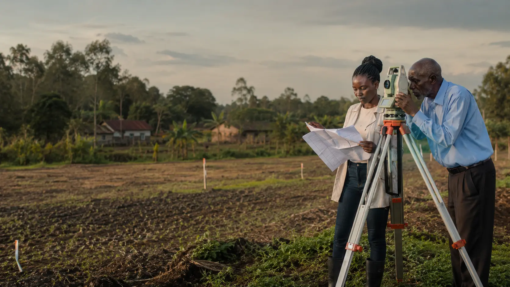
- A licensed surveyor, to fix boundaries and to set out anything requiring accurate levels.
- A civil or agricultural engineer, for any earthworks beyond simple site clearing, for culverts, and for any structure on a slope.
- NEMA or the district environment officer, if any part of the site is near a wetland, river or lakeshore.
- An advocate registered in Uganda, for any boundary, access or tenure question.
- A veterinary or environmental health officer, for the local requirement on siting animal housing relative to dwellings and water.
Clear next actions
- Walk your boundaries this week and mark every one on a sketch.
- Book a second site visit for the next heavy rain and record where water goes.
- Fill in the survey table above, leaving nothing blank. A blank row is an unmade decision.
- Draw the site, photocopy it, and test at least two different layouts on paper.
- Peg your preferred layout on the ground and leave it through a wet season.
- Contact your district physical planning office and ask what permission your intended works require.
- Complete the layout decision sheet, including rejected alternatives, and file it with the farm records.
- Only then commit phase 1.