
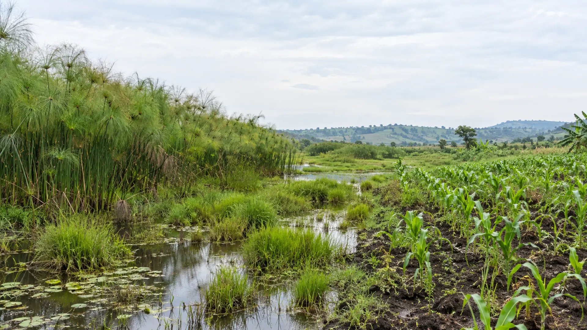
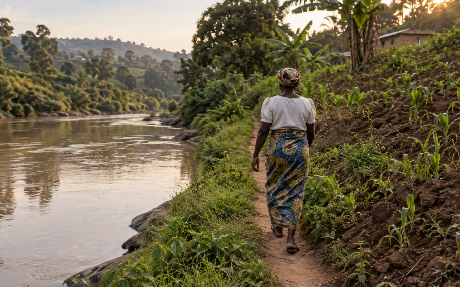
A great deal of Ugandan farming happens on ground that is wet for part of the year. Seasonal wetland margins hold moisture into the dry months. River banks carry the best soil on a hillside farm. Lake shore land is flat, fertile and close to water.
All of it is regulated, and most of the people farming it have never seen the regulations.
This guide sets out what we were able to verify by reading the instruments themselves: the prohibitions, the buffer distances, the permit route, the document list and the penalties. It then does something most writing on this subject avoids, and identifies precisely where the legal position is genuinely uncertain.
That uncertainty is not a failure of research. It is the actual state of the law, and a farmer making a decision about land is better served by knowing where the uncertainty sits than by being handed a confident figure that may not hold.
Before anything else. This article is not legal advice, and Falcon Foundation Ltd is not a law firm. It is a reading of published instruments, with the instruments named so that you or your adviser can read them too. On a question that can end in a restoration order or a criminal penalty, the district environment office and a qualified adviser are the people whose answers count.
What the 2019 Act prohibits
The governing instrument is the National Environment Act, 2019. It repealed and replaced the earlier National Environment Act, and it is the document to start from.
Section 55(1) sets out what may not be done in a wetland without approval. The opening words matter as much as the list: “A person shall not, without the written approval of the relevant lead agency, given in consultation with the Authority” carry out any of six activities. Those are, in the Act’s own terms, to reclaim or drain any wetland; to erect, construct, place, alter, extend, remove or demolish any structure fixed in, on, under or over any wetland; to disturb any wetland by drilling or tunnelling in a manner that has or is likely to have an adverse effect; to deposit any substance in a manner that has or is likely to have an adverse effect; to destroy, damage or disturb any wetland in a manner that has or is likely to have an adverse effect on any plant or animal or its habitat; and to introduce any alien plant or animal.
Three observations for a farmer.
The prohibition is on activities, not on presence. Walking across a wetland is not in the list. Draining one is.
Paragraph (e) is the broad one. To “destroy, damage or disturb any wetland in a manner that has or is likely to have an adverse effect on any plant or animal or its habitat” is wide enough that a farmer clearing and cultivating wetland vegetation should assume it applies to them, and should not rely on the absence of the word cultivation from the list.
Approval is written approval, from a lead agency, in consultation with the Authority. Nothing about this is informal. A verbal assurance from anybody is not approval within the meaning of the section.
Section 55(2) says that a person wishing to carry out one of these activities “shall apply to the lead agency in writing.” Section 55(3) allows the lead agency to investigate the effect of the proposed activity and to require an environmental and social impact assessment. Section 55(4) imposes a duty on the lead agency to ensure “that there is no net loss to the affected wetland” from an activity assessed in that way.
Section 54(2) is short and consequential: “Government or a local government shall not lease out or otherwise alienate any wetland.” A farmer offered a lease or an allocation of wetland by a local authority should read that sentence before parting with money.
The penalty in section 55(6) is severe: a person contravening subsection (1) “is liable on conviction to a fine not exceeding thirty thousand currency points or imprisonment not exceeding twelve years or both.”
The buffer distances, and where they come from
The distances are not in the 2019 Act. They are in a statutory instrument, and understanding that is the key to understanding the uncertainty in this article.
Cultivating Near Wetlands, Rivers and Lake Shores in Uganda: What the Law Says and What Is Genuinely Unclear
A reference table of the four protection zone distances for scheduled rivers, other rivers, scheduled lakes and other lakes, each with its stated measuring point and its regulation number.
The instrument is the National Environment (Wetlands, River Banks and Lake Shores Management) Regulations, 1999, published as Statutory Instrument 2000 No. 3. Its own face states that it is made under section 108 of the National Environment Statute, 1995.
Four distances are set.
Rivers named in the schedule. Regulation 29(1) provides a protection zone of one hundred metres from the highest water mark.
All other rivers. Regulation 29(2) provides thirty metres from the highest water mark.
Lakes named in the schedule. Regulation 30(1) provides two hundred metres measured from the low water mark.
All other lakes. Regulation 30(2) provides one hundred metres from the low water mark. Regulation 30(4) deals with natural beaches, where the measurement runs from the point at which the beach merges with the vegetation.
The named rivers in the Sixth Schedule include the Nile, Aswa, Katonga, Nkusi, Kafu, Rwizi, Kagera, Mpanga, Manafwa, Mpologoma, Semliki, Mubuku, Mayanja, Sezibwa, Malaba, Sipi, Namatala, Sironko, Muzizi and Nabuyonga. The named lakes in the Seventh Schedule include Victoria, Kyoga, Albert, Edward, George, Bisina, Mburo, Bunyonyi, Kijanibarora, Kwania, Wamala, Mutanda, Marebe, Opeta, Nabugabo, Nkugute, Katunga, Nyabihoko and Nakivale.
Two practical points that cause more trouble than the numbers themselves.
The measuring point differs. Rivers are measured from the highest water mark. Lakes are measured from the low water mark. These are not the same kind of point, and on a lake shore with a wide seasonal range the difference is substantial. Measuring a lake buffer from the current water line in a wet month will put you in the wrong place.
The 2019 Act defines the bank differently again. Section 53(8) of the Act defines a “lakeshore” as “the land not more than 100 metres adjacent to or bordering a lake” and a “river bank” as “the rising ground, not more than 100 metres long, bordering or adjacent to the natural course of a river.” Those are definitions of the physical feature, used in the Act’s own protection provisions, and they do not replace the regulation distances. A reader who encounters both will find them easy to confuse.
If you are assessing a hillside plot with a watercourse running through it, the erosion and drainage considerations sit alongside the legal ones and are dealt with in soil erosion control on Ugandan slopes and flooding, waterlogging and drainage recovery.
The part nobody else will tell you
Here is the difficulty, stated as plainly as we can.
Cultivating Near Wetlands, Rivers and Lake Shores in Uganda: What the Law Says and What Is Genuinely Unclear
A two-column panel comparing the traditional uses exempted by the 2019 Act against the uses exempted by the 2000 regulations, showing that cultivation appears in one list and not the other.
Regulation 11(2) of the 2000 regulations exempts certain traditional uses from the permit requirement. Those are, in the regulation’s own terms, harvesting of papyrus, medicinal plants, trees and reeds; cultivation of an area not exceeding a quarter of the total area of the wetland; fishing using traps, spears and baskets or other method other than weirs; collection of water for domestic use; and hunting subject to the provisions of the wildlife law. Regulation 11(3) allows the Executive Director to restrict or prohibit these activities where they endanger wetland resources.
That cultivation exemption is the single most consequential sentence in the whole subject for a Ugandan farmer, and it is the one whose status we cannot confirm.
Here is why.
The regulations were made under a repealed Act. Statutory Instrument 2000 No. 3 states on its face that it is made under section 108 of the National Environment Statute, 1995. That Statute is gone, replaced by the 2019 Act. Instruments made under a repealed Act commonly survive by means of a savings provision in the new Act. Section 182 of the 2019 Act is headed repeal and savings. We were not able to read its full text in the copies available to us, and we therefore will not assert either that the regulations survive or that they do not.
The 2019 Act’s own exemption list does not include cultivation. Section 55(5) provides that the lead agency “shall, in consultation with the Authority, and by statutory instrument, exempt any traditional use of wetlands referred to in section 54(11) considered to be a sustainable use” from the prohibition. Section 54(11) then lists the traditional uses: harvesting of papyrus, medicinal plants, trees and reeds; fishing using traps, spears and baskets or other method other than weirs; collection of water for domestic use; and hunting subject to the Uganda Wildlife Act.
Compare those four with the five in the regulations. Cultivation is in the older list and absent from the newer one.
We are not going to tell you what that means, because we do not know, and neither does anybody who has not read a savings provision we could not open or a later instrument we could not find. What we can tell you is what a careful farmer should do with it.
Do not treat the quarter-of-the-wetland cultivation exemption as a settled right. It may well be recognised in practice. It may be preserved by the savings provision. It is not, on the face of the newer Act, one of the uses that Act contemplates being exempted.
Ask, in person, and write down the answer with a name against it. That is what the enquiry script later in this guide is for.
Do not build an investment on it. There is a difference between continuing an established practice and clearing new ground on the strength of a provision whose status is open. The second is a risk that can end in a restoration order.
We also searched specifically for a grandfathering provision, protecting people who were cultivating wetland before these rules came into force. We found none, in either instrument. That is a clean negative finding and it is reported here as one. A reader whose family has farmed a wetland margin for thirty years should understand that neither instrument, as we read them, says anything that protects that position.
Assessing your own land
Before any conversation with an office, work out what you are actually dealing with.
Cultivating Near Wetlands, Rivers and Lake Shores in Uganda: What the Law Says and What Is Genuinely Unclear
A blank land risk assessment worksheet with numbered steps for identifying the water feature, finding the measuring point, establishing whether the feature is scheduled, measuring the distance and recording the result.
The worksheet has six steps, and two of them are where people go wrong.
Step two, the measuring point. Rivers from the highest water mark, lakes from the low water mark, natural beaches from where the beach merges with the vegetation. Get this wrong on a lake shore and every measurement that follows is wrong.
Step three, whether the feature is scheduled. The difference between a scheduled and an unscheduled river is seventy metres. The difference between a scheduled and an unscheduled lake is a hundred metres. A farmer who assumes the smaller figure applies because the water looks small may be a long way inside a protected zone.
Two further points about the assessment.
A wetland is a gazetted thing. The Act’s definition in section 2 describes wetlands as areas permanently or seasonally flooded by water, where plants and animals have become adapted, and gazetted as such. Whether the ground near you is a gazetted wetland is a question of record, not of appearance, and the district office is where that record is consulted.
Pace or tape the distance. An estimate made by eye across broken wet ground is not a measurement. Walk it.
The worksheet produces a record, not a determination. Its value is that it lets you arrive at a district office with a specific question rather than a general worry.
The permit route and the documents
If the answer is that you need a permit, this is the route the regulations describe.
Cultivating Near Wetlands, Rivers and Lake Shores in Uganda: What the Law Says and What Is Genuinely Unclear
A process diagram of the wetland and river bank permit route with the required document list beside each stage and blank boxes for recording dates.
Regulation 12(1) states the general rule: “Subject to the provisions of these Regulations, a person shall not carry out any activity in a wetland without a permit issued by the Executive Director.” Regulation 11(1) provides that a person wishing to carry out a regulated activity or extract wetland produce applies on the prescribed Form A. Regulation 23 provides for river bank and lake shore permits on Form B.
The document requirements are where most applications stall.
Local endorsement is built into the form. The prescribed application form requires the comments of the local council secretary and the approval of the district environment committee. This is not an optional supporting document. The form is not complete without it, and obtaining it is a process with its own timetable.
There are two fees, not one. The Fourth Schedule sets an application fee and a separate fee payable on the grant of the permit, at the figures printed in the regulations. Fee schedules are amended from time to time and the current figures should be confirmed rather than assumed from a published table.
Boundary maps are contemplated. Regulation 10(3) provides for boundary maps of the area concerned. An application that cannot show where the boundary of the area is will not get far.
An assessment may be required. Section 55(3) of the Act allows the lead agency to require an environmental and social impact assessment. For a small cultivation application this may not arise, but the power is there and the applicant should know it exists before committing to a timetable.
The National Environment Management Authority publishes the river bank and lake shore user permit information and the combined wetland, river bank and lake shore application form on its website, and operates an electronic revenue system for the associated payments. Those pages were not reachable from our research environment at the time of writing, which is itself worth knowing: if you cannot reach them either, that is a reason to go to the district office rather than to assume the requirement has lapsed.
If your plan involves taking water as well as cultivating near it, the abstraction permit question is separate and is covered in water abstraction permits and borehole drilling.
Conditions, revocation and restoration
A permit is not a settlement. The regulations attach continuing obligations, and a farmer planning a multi-year enterprise on permitted ground should read them before planting.
Permits can be revoked. Regulation 14 provides for revocation.
Restoration can be required. Regulation 16(d) requires restoration within one year after expiry or revocation. That is an obligation that survives the permit itself, and it falls on the permit holder.
Restoration orders exist independently. Regulation 35 provides for restoration orders. Note that this regulation as drafted cites sections of the repealed 1995 Statute, which is a further illustration of the point made earlier in this guide about the age of the instrument.
The penalties in the regulations differ from those in the Act. Regulation 38(1) provides for imprisonment of not less than three months or a fine not exceeding three million, or both, and regulation 38(2) provides for community work. Those figures sit alongside, and are considerably lower than, the penalty in section 55(6) of the 2019 Act. A reader encountering both should understand that they come from different instruments of different ages.
The practical consequence for farm planning is straightforward. Permitted use of protected land is conditional and reversible, and the restoration obligation means the cost of exit is not zero. That belongs in the enterprise decision, and the framework for making that kind of decision is in choosing a farm enterprise and verifying land title and tenure.
Why this is being enforced more, not less
It helps to understand the pressure behind the rules, because it tells you which way enforcement is likely to move.
Uganda’s own State of Wetland Report published in 2022 gives the national wetland area at three points. In 1994 it stood at 37,559.4 square kilometres, or 15.6 per cent of the country’s surface. By 2015 it had fallen to 31,412.7 square kilometres, or 13 per cent. By 2022 it had recovered somewhat to 33,762.6 square kilometres, or 13.9 per cent.
The same report states the land cover change behind those figures: “Between 1994 and 2022, grasslands and woodlands decreased by 31% and 12% respectively whereas the farmlands increased by 28%.”
Two honest readings of that.
The direction of travel is clear. Wetland area is well below its 1994 level and farmland has expanded substantially over the same period. A reader can see why wetland protection has moved up the national agenda.
The 2015 to 2022 movement is upward. Whatever has been happening since 2015, the reported national figure rose. We report that because it is in the same document, and an article that quoted only the decline would be selecting.
What this means for a farmer is practical rather than political. Rules that exist on paper and are enforced unevenly tend to be enforced more consistently when the problem they address becomes a national priority. Land use decisions made on the assumption that nobody will ask are riskier now than they were a decade ago.
The district enquiry
Everything above ends in the same place: a conversation with the district environment office, in which you ask specific questions and record specific answers.
Cultivating Near Wetlands, Rivers and Lake Shores in Uganda: What the Law Says and What Is Genuinely Unclear
A blank enquiry script sheet with seven questions to ask a district environment officer and ruled space to record each answer, the name of the person who gave it and the date.
Take the script. Ask the seven questions. Write down the answers, and write down who gave them and when.
The reason for recording the name is not to build a case against anybody. It is that the position varies between districts and changes over time, and a farmer who can say that a named officer confirmed a specific position on a specific date is in a far better position than one relying on a recollection of a conversation.
Three questions on that sheet are the ones that matter most.
Is this land within a gazetted wetland? This is a record question with a record answer.
Which schedule, if any, does the adjoining river or lake fall under? This sets the distance.
Are the 2000 regulations applied in this district, and is the cultivation exemption recognised? This is the open question this guide has been honest about, and the district office is the only place a farmer can get a usable answer to it.
Do not expect the answers to be quick, and do not expect them to be identical to what a neighbour was told in another district. Both of those are consequences of the legal position described above rather than failures of the office.
What to do with all of this
For a farmer with existing cultivation on or near protected ground, the sequence is: measure it, establish which rules apply, ask the district, record the answer, and make the investment decision with the uncertainty priced in rather than ignored.
For a farmer considering new ground near water, the sequence is shorter. Do the assessment first. Ask before clearing. The restoration obligation and the penalty provisions mean that the cost of getting this wrong is not a fine you weigh against a season’s crop. It is potentially the loss of the improvement and an order to put the land back.
And for anybody who has been told confidently that farming a quarter of a wetland is permitted, the honest position is this. That provision is written in an instrument made in 2000 under an Act repealed in 2019. The newer Act’s own list of traditional uses does not include cultivation. Whether the older provision survives depends on a savings provision we could not read and on how the lead agency has exercised the power in section 55(5). Until you have that answer from the office that would enforce it, treat it as an open question rather than a right.
That is a less satisfying conclusion than a number. It is the one the documents support.
Author: Falcon Foundation Ltd Editorial Team
The Falcon Foundation Ltd Editorial Team produces evidence-based agricultural guidance for Ugandan farmers, drawing on published research and institutional sources and translating them into practical decision support. Where evidence is unavailable or contested, we say so rather than filling the gap.