The direct answer
Waterlogging costs yield fast, and the cost rises steeply with every extra day the water stays. A global meta-analysis published in 2021 found that for maize under field conditions, waterlogging led to yield decreases of 22.43, 39.77, 52.72 and 76.33 in experiments with durations of 0 to 3, 3 to 6, 6 to 9 and 9 to 15 days respectively, compared with no waterlogging. Those are pooled global research figures, not a Ugandan measurement, but the shape of the relationship is the point: the difference between three days and nine days of standing water is the difference between a reduced crop and no crop.
That single fact sets the whole approach. Drainage is a speed problem, not a volume problem. What matters is how quickly excess water leaves the root zone, and everything you build on the field is judged by that.
There are three practical layers, and most Ugandan farms need all three.
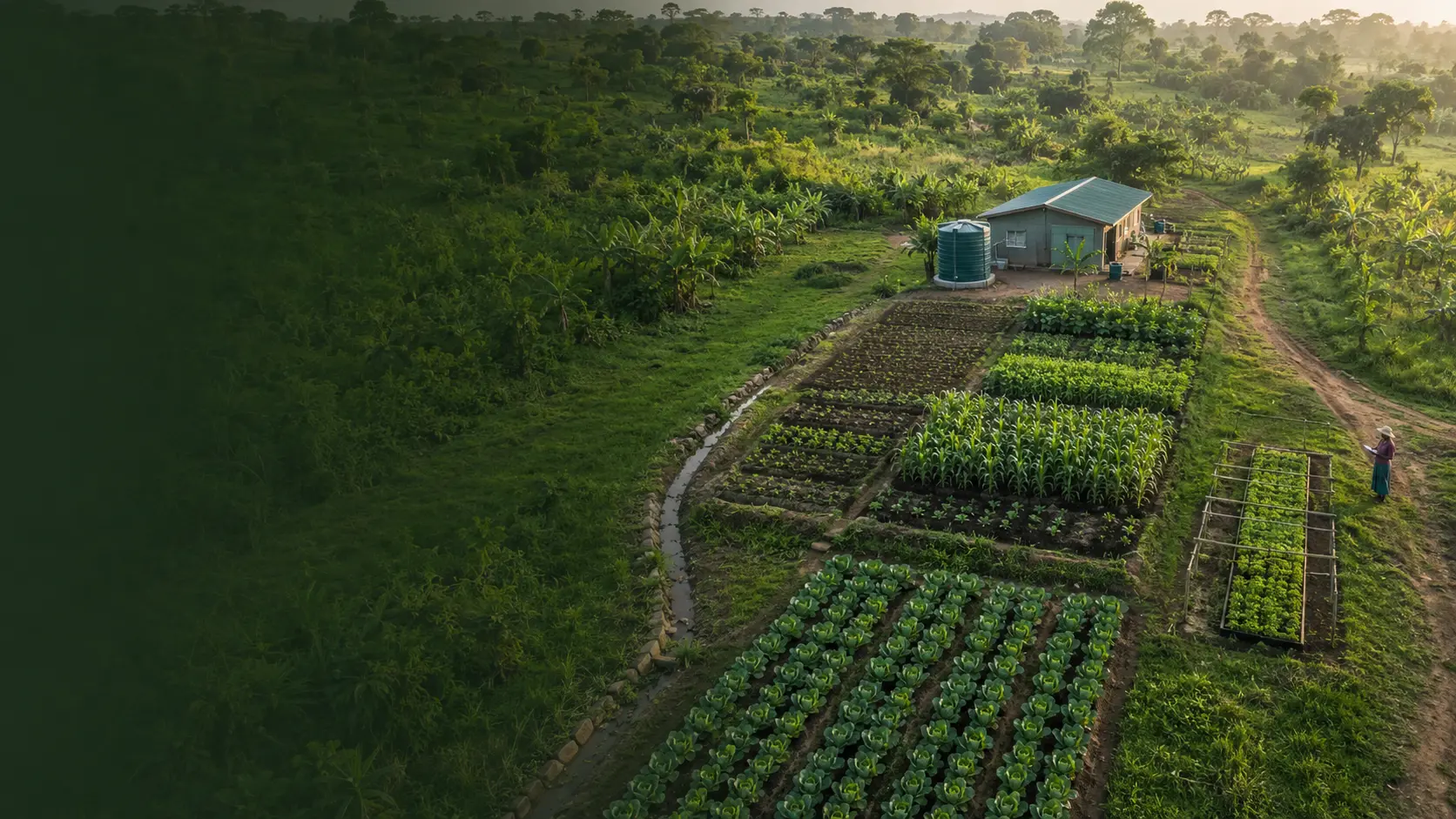
Get the water off the surface. FAO describes surface drainage as "the removal of excess water from the soil surface in time to prevent damage to crops", achieved by "excavation of open trenches/drains" or "construction of broad-based ridges or beds, as grassed waterways", and states that it is most applicable "on heavier soils where infiltration is slow and excess rainfall cannot percolate freely through the soil profile" and that it is "the most important drainage technique in the humid and subhumid zones."
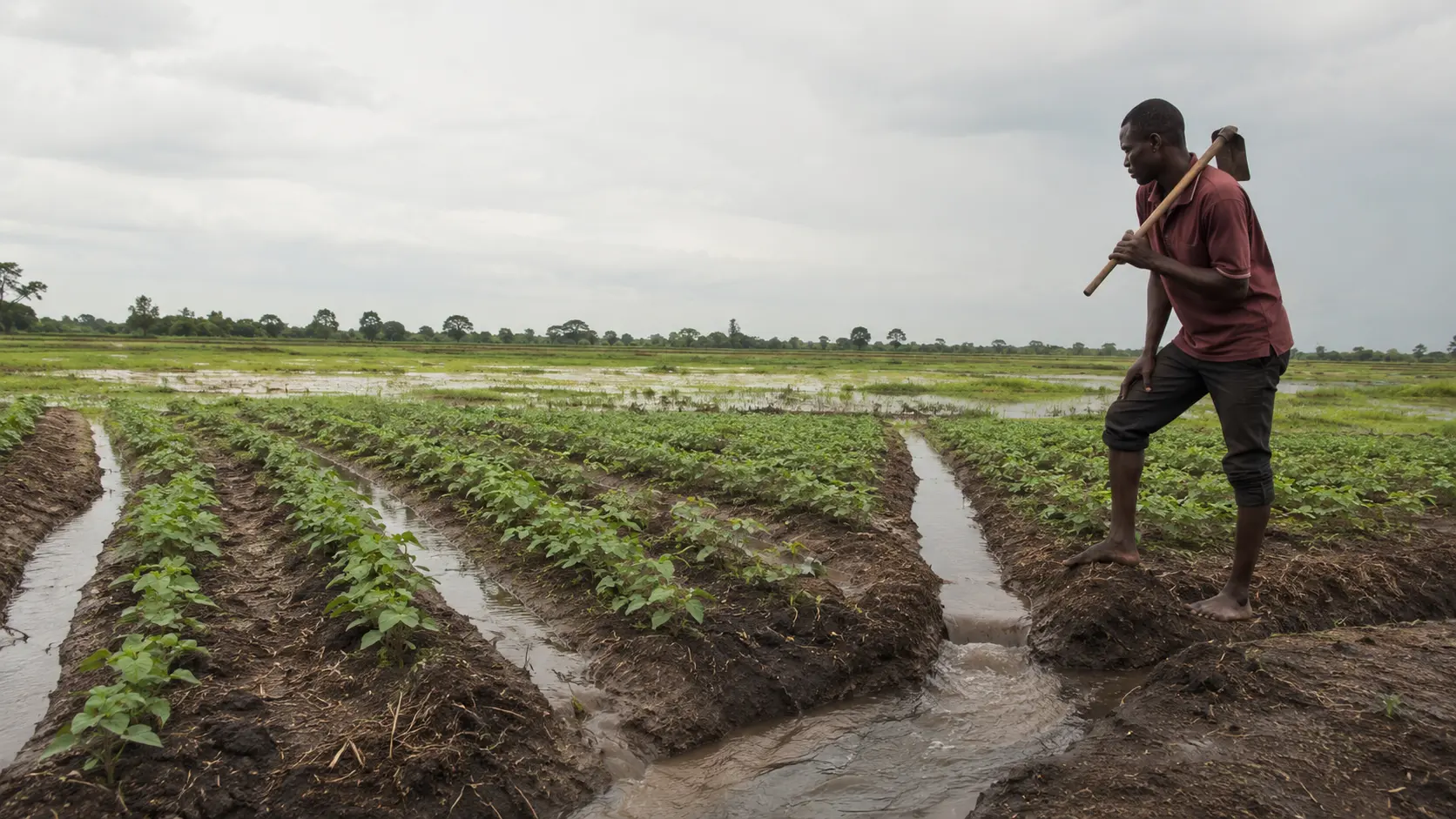
Lift the crop above the water. Beds and ridges create strips that hold less water, with the furrows between them carrying the excess away.
Recover the field afterwards, and make a decision about the crop that was in it.
There is also a legal layer that many farms breach without knowing. Draining or reclaiming a wetland is a named offence in Ugandan law. The section below sets out the provision and what it means before you dig.
Who this article is for
You farm in Uganda on land that holds water: a flat field on heavy clay, a valley bottom, a field below a slope that sheds water onto you, or land in one of the areas Ugandan sources name as flood-prone. You lose crop most years to standing water, or you lost a season to a flood, and you want to know what to build, what it will actually achieve, and what you are allowed to do.
The problem this article solves
The speed problem. Most farms think about drainage in terms of whether water eventually leaves. The research says the damage is done in days. A field that drains in three days and a field that drains in nine days are agronomically different fields.
The invisible loss. Flood damage is obvious. Waterlogging is not. A field that holds water for four days after every heavy rain loses yield every season, quietly, and the loss is attributed to soil fertility, seed quality or the weather in general.
The legal problem. The most obviously available drainage route on many Ugandan farms is the wet ground at the bottom of the plot, and draining that ground may be a criminal offence.
The aftermath problem. After a flood there are two separate questions that get merged: what happens to the field, and what happens to the produce. They have different answers and different authorities.
The decision you are making
You are deciding, for one field:
- Where the water actually comes from, where it stands and where it can legally and physically go.
- Whether the answer is surface drains, beds and ridges, a change of crop or enterprise, or accepting the field as it is.
- What the layout will be, sized from your own field rather than from a published dimension.
- What you will do after a flood: with the field, and with the crop that was in it.
You are not deciding to reclaim a wetland. That decision is not yours to make, and the section below explains why.
Uganda-specific context
The wetland law, and the limit of what can be stated
The National Environment (Wetlands, River Banks and Lake Shores Management) Regulations, made on 23 December 1999 and issued as Statutory Instruments 2000 No. 3, create offences at regulation 37. The provision opens: "A person who- (a) reclaims or drains a wetland; (b) erects, constructs, places, alters, extends removes or demolishes any structure that is fixed in, or, under or over a wetland; (c) disturbs a wetland by drilling or tunnelling in manner that has or is likely to have an adverse effect on a wetland..."
Regulation 38 sets the penalties: "(1) Any person found guilty of an offence under these Regulations is liable on conviction to imprisonment of not less than three months or to a fine not exceeding three million or both. (2) In addition to the sentence provided for in sub-regulation (1), a person found guilty may be required to carry out community work that promotes the conservation of wetlands."
Read regulation 37(a) carefully. Reclaiming or draining a wetland is the first-named offence. Not damaging it, not polluting it. Draining it. That is exactly the operation a farmer performs when a field's low wet corner is opened up to make it cultivable, and it is the most common way a Ugandan farm commits an environmental offence without intending to.
The honest limit. Uganda's environmental law was substantially restated by the National Environment Act, 2019. Falcon could not obtain the text of that Act's wetland provisions during this research, despite repeated attempts through the environment authority's own site, the legal information institute and other routes. This article therefore cites only the 1999 regulations, with their regulation numbers, and cites no section of the 2019 Act.
What that means for you is practical. Do not treat the 1999 regulations as the complete current position. Before you excavate any drain on or toward wet ground, ask the National Environment Management Authority or your district environment officer whether the ground is a wetland and what approvals apply. That is a question with a criminal penalty attached, and it is worth a phone call.
Where flooding falls in Uganda, according to Ugandan sources
At the launch of the National Risk and Vulnerability Atlas in February 2021 it was reported that floods are dominant in the Elgon, Bukedi, Rwenzori, Teso, Karamoja, Buliisa, Nakasongola, Acholi and West Nile areas.
The World Bank Group and GFDRR disaster risk profile for Uganda, published in 2019, identifies flood-prone land in four areas: "in the northwestern region along the White Nile; south along the Semliki River on the border with the Democratic Republic of Congo; in the Central region, east of Lake Kyoga and Lake Nakuwa; and in the region around the southern lakes in Rakai, Isingiro, and Kiruhura districts." It states that on average river flooding affects at least 45,000 people, with 300,000 people exposed in a one-in-fifty-year event, and names Kamuli and Kayunga as the most affected districts. Those are 2019 modelled national figures.
What a Ugandan flood cost, in crop terms
The FAO and WFP special report of 18 January 2008 assessed the impact of the 2007 floods on food and agriculture in eastern and northern Uganda. For Amuria District in the first season it recorded area lost of 26,377 hectares out of 59,576 hectares planted. For Katakwi District it recorded area lost of 22,206 hectares out of 51,949 hectares planted. It recorded a deficit for Amuria of 16,419 tonnes of cereals and 27,743 tonnes of roots and tubers, and for Katakwi a cereal deficit of 3,315 tonnes, and it stated that 320,924 people would require fresh assistance in 2008 at least partly as a result of the floods.
Those are figures for one event in 2007 in two named districts, from a joint assessment published in 2008. They are given to show the scale a single flood season reached in Ugandan districts, and nothing in this article extrapolates them to any other year or place.
The bean farmers of Kisoro, and why practice matters
A 2013 study of farmers on the Uganda side of the Uganda and Rwanda border region, in Kisoro district, surveyed 96 respondents drawn randomly at village level from a list of 500 households, on common bean production under waterlogged conditions. It records that "bush beans are severely affected by frequent water-logging which persists over a considerable period of the year. In spite of this, farmers have continued to cultivate bush bean though with miserable yields." Its findings were that "farmers possess vital coping mechanisms including construction of ridges, fertiliser application and chemical control of pests and diseases to expedite plant growth, and construction of drainage channels."
Two things follow. Ridging and drainage channels are already the Ugandan farmer practice, so this article is describing how to do better what is already being done. And this was a survey of practices, not a trial: it reports no percentages of farmers per practice and no yield results, so no effectiveness claim is drawn from it.
What waterlogging actually does to the crop
Understanding the mechanism explains why speed matters and why some damage does not recover.
When soil saturates, the air spaces fill and oxygen is depleted. A 2025 review states that "Once the soil becomes saturated, oxygen depletion leads to anaerobic respiration in plant roots, weakening their respiratory processes", that this "forces roots to shift to anaerobic respiration, impairing cellular gas exchange", and that "Hypoxia in roots disturbs endogenous hormone levels, reducing water and nutrient absorption". The visible result is a crop that looks short of water while standing in water, because the roots can no longer take it up.
For maize specifically, a 2025 review in the Journal of Experimental Botany describes the response and its limit. In roots, "lysigenous aerenchyma formation is triggered by hypoxia, ethylene, and reactive oxygen species signaling, facilitating internal oxygen diffusion", which is the plant creating internal air channels. But "maize lacks a tight barrier to radial oxygen loss", which is why that adaptation is incomplete, and the shoot-level consequences are stated as follows: "Shoot-level physiological changes-including reduced stomatal conductance, impaired photosynthesis, and premature senescence-may result from oxidative stress signaling. Leaf damage persists long after soil saturation ends, indicating limited recovery capacity."
That last sentence is the one to remember. The crop does not simply resume when the water goes. This is why the duration figures at the top of this article rise so steeply, and why a drain that shortens standing water from nine days to three is worth more than most other investments on a wet field.
The 2021 meta-analysis also found, across all crops, that "decreases in crop yield were observed with an extension in the waterlogging duration; the greatest decreases in crop yield occurred at 15 < D <= 28 (53.19 and 55.96%) under field and potted conditions, respectively." Those are pooled global figures across crops and are quoted with that scope.
Falcon looked for a published figure on how quickly soil oxygen is depleted after flooding and the review consulted gives none, so none is stated here.
Step by step: assess the field and choose the approach
Step 1: find out where the water comes from
Walk the field during or immediately after heavy rain, not on a dry day. Water on a field has three possible origins and the remedy differs for each.
Rain falling on the field itself that cannot infiltrate, typically on heavy clay. The remedy is surface removal and improving infiltration over time.
Run-on from above, water arriving from a slope, a road, a compacted track or a neighbour's land. The remedy is upslope interception, and the erosion control article referenced at the end deals with the structures.
A high water table or a river or lake rising. Neither drains nor beds solve this, and the honest answer may be a change of crop, a change of season, or accepting the field for a different use.
Write down which of the three you have. Farms routinely build the wrong structure because this step was skipped.
Step 2: map where the water stands and how long it stays
Mark the low points and the extent of standing water on a sketch of the field, and record the date, the rainfall event and, critically, how many days the water stayed. That day count, held against the duration bands at the top of this article, is the measure of how much this field is actually costing you.
Repeat over a season. Two or three observations turn an impression into evidence.
Step 3: establish where the water can legally and physically go
Water removed from a field has to arrive somewhere. Before you plan anything, establish two things.
Legally: whether the receiving ground is a wetland, a river bank or a lake shore. Regulation 37 of the 1999 regulations makes reclaiming or draining a wetland an offence, and regulation 38 attaches imprisonment of not less than three months or a fine, or both. Ask the National Environment Management Authority or your district environment officer.
Practically and neighbourly: whether the discharge point puts water onto a neighbour's land, a road or a track. A drain that solves your problem by creating theirs is a dispute waiting to happen, and often a legal one.
Step 4: choose between surface drains, beds and ridges, or a change of use
The framework is in the next section. The short version: surface drains move water off the field, beds and ridges lift the crop above the water within the field, and most wet fields need some of both.
Step 5: size the layout from your own field
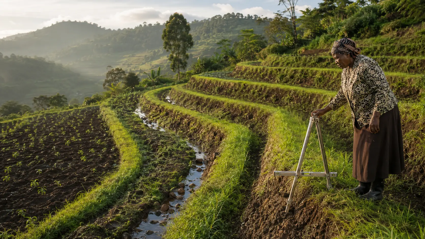
This article publishes no universal spacing, depth, width or gradient. FAO's guidance on land drainage systems reviewed for this article names the flat-land options, including "Furrow at the downstream end of a field", "Ridges and furrows", "Convex raised beds and furrows", "Parallel surface drains at wide spacings" and "Parallel small ditches", and for sloping land "Cross-slope drain systems" and "Random field drainage systems", but that document is oriented to engineers with a previous drainage background and the numeric dimensions in it could not be recovered during this research. Falcon will not invent them.
Two sets of published dimensions do exist and both come with conditions that must travel with them. They are given in the beds section below as illustrations of what such systems look like elsewhere, not as specifications for your field.
Size your own layout by observation: bed width that your own cultivation and harvesting can work across, furrow depth sufficient that water actually flows to the outlet rather than standing in the furrow, and fall in the direction the water already goes. Build a small area first and watch it through one wet period before committing the whole field.
Step 6: build in the dry period
Drains and beds built during the wet season are built badly, in mud, and often not at all. This is the same discipline as the drought article's rule about storage: the structure has to exist before the condition arrives.
Step 7: watch the outlet and maintain
A drain is only as good as its outlet. Silt, weed growth, collapsed sides and a blocked discharge point convert a working drain into a storage channel. Inspect after every major rainfall event and clear before the next season.
Step 8: record what changed
Record the days of standing water in the same field after the works as before them. That comparison is the only proof you will get that the work was worth doing, and it is the number that justifies extending the approach to the next field.
Decision framework: which approach for which situation
| Situation | Surface drains | Beds and ridges | Change of crop, season or use | Notes |
|---|---|---|---|---|
| Heavy clay, flat, rain ponds on the surface | Primary remedy | Strong support | Only if drainage cannot achieve a workable day count | FAO identifies surface drainage as most applicable on heavier soils with slow infiltration |
| Run-on from a slope, road or track above | Interception above the field is the primary remedy | Secondary | No | Deal with the source; the erosion control article covers upslope structures |
| Field floods from a river or lake rising | Limited, and may not be safe or lawful | Limited | Seriously consider this | Neither drains nor beds hold back a river |
| High water table for part of the year | Limited effect | Helps, by raising the root zone | Consider a seasonal crop calendar instead | Beds raise the crop; they do not lower the water table |
| Wet corner or strip that is wetland | Do not drain | Not applicable | Yes, leave it and plan around it | Regulation 37(a) makes reclaiming or draining a wetland an offence |
| Occasional flooding, otherwise good field | Yes, sized for the event you actually get | Yes, for the flood-prone part | No | Combine with the post-flood recovery plan below |
| Valley bottom cultivated seasonally | Case by case, and check the wetland position first | Common practice | Often the right answer | Establish the legal position before excavating anything |
Beds and ridges: what they do and what published systems look like
The function is straightforward. FAO describes bedding systems in these terms: "Bedding systems are applied to create strips with less waterlogging in between furrows, which convey excess surface water to ditched field borders." The bed carries the crop and stays relatively drier; the furrow carries the water away. That is the whole principle, and it works because it addresses duration, which is what the yield figures at the top of this article say matters.
Two published sets of dimensions exist, and both are foreign, both are for other crops and conditions, and neither is a specification for a Ugandan field.
A continental catalogue entry for furrow-irrigated raised bed wheat production, naming Ethiopia, Nigeria and Sudan as the countries and wheat as the crop, describes: "Raised beds, 40-130 cm wide and 10-20 cm tall, with furrows 20-50 cm wide in between." Note that this is a system for irrigated wheat production in those three countries, and that its purpose there is as much about irrigation efficiency as about drainage.
An Ethiopian field trial published in 2021 tested broad bed and furrow lengths for durum wheat on Vertisols in the central Ethiopian highlands, in the Minjar-Shenkora district at 2,257 metres elevation, with rainfall of 612 and 635 mm in the two study years, in the 2015 and 2016 seasons, using the durum wheat variety Ude. Its beds were 80 cm wide with 20 cm furrows set at 15 cm depth, and it compared furrow lengths of 10, 20 and 30 metres across slopes of 1, 2 and 3 per cent. The best grain yield reported was 5,757 kg per hectare from the 10 metre bed and furrow length at 2 per cent slope; at 1 per cent slope with 20 metre beds the reported yield was 2,148 kg per hectare, and at 3 per cent slope with 20 metre beds it was 3,318 kg per hectare.
Read that trial for its structure rather than its numbers. What it demonstrates is that furrow length and slope interact, and that the same bed dimensions gave very different results at different lengths and slopes on the same soil type. On your field, the equivalent question is how far water has to travel in your furrow before it reaches an outlet, and that is a question about your field's fall and length, not about Ethiopia's.
What Falcon will not do is convert those foreign dimensions into a Ugandan recommendation. The soils differ, the crops differ, the rainfall differs, the elevation differs and the purpose differs. Use them to understand the shape of the system, then size your own beds from your own field, your own cultivation method and one small trial area.
One further caution. Research on tied ridges and furrows in semi-arid regions of Asia and Africa reports yield gains for sorghum and millet, but that is a water-harvesting application of ridging in dry conditions, and it is not drainage evidence. Do not let ridging research from semi-arid water harvesting be read as support for ridging as a drainage remedy. They are opposite problems using a similar shape.
After a flood: the field and the produce are two different decisions
The field
Once the water has gone, the field needs assessment before it is worked.
- Do not cultivate saturated soil. Working wet soil compacts it, and compaction is what makes the next flood worse. Wait until it will bear the operation.
- Check what the water left. Silt deposits, debris, and material washed in from elsewhere, including from tracks, latrines or upstream farms.
- Check what the water took. Topsoil, seed, planted crop, structures and the drainage works themselves. The erosion control article referenced at the end deals with the loss side.
- Re-establish soil cover as soon as the ground will take it, so that the next event does less damage. The composting and organic matter article and the rotation and cover crop article referenced at the end deal with how.
- Repair the drains and the outlet before the next rain, because a flood is the event most likely to have blocked or collapsed them.
- Consider soil testing where flooding has been substantial, since the nutrient position may have changed. The published soil testing article referenced at the end covers how.
The produce, and the honest limit on this guidance
This is the part where the available guidance is foreign and must be labelled as such.
United States extension guidance on food safety for flooded fields states: "Throw away produce that comes into direct contact with floodwaters", advises growers to "Wait at least 30-60 days before replanting flooded fields with vegetables", and tells growers to "base decisions on your own risk assessment and the extent of flooding."
United States federal guidance from 2011 on evaluating the safety of flood-affected food crops states that "If the edible portion of a crop is exposed to flood waters, it is considered adulterated under section 402(a)(4)", that "These crops be disposed of in a manner that ensures they are kept separate from crops that have not been flood damaged to avoid adulterating 'clean' crops", that "A 30-feet buffer zone is generally recommended between flooded areas of fields and areas to be harvested for human consumption", and that "State, industry, and university extension specialists have recommended a 30-60 day waiting period and/or soil testing prior to replanting."
Both of those are United States sources describing United States regulatory and extension positions. The adulteration provision quoted is a United States statutory reference and has no application in Uganda. Falcon quotes them because they are the clearest published statement of the underlying food safety concern, which is that floodwater carries contamination from wherever it has been, and that contamination does not distinguish between countries.
For the Ugandan position, ask MAAIF, the Uganda National Bureau of Standards or your district production office. If you supply a buyer, an exporter or a processor, ask them what their standard requires, because their requirement may be stricter than any national one, and the food safety and residues article referenced at the end deals with that framework. This article states no Ugandan legal rule on flood-affected produce, because none was verified.
The underlying caution is one that applies regardless of jurisdiction: floodwater is not clean water, the edible portion of a crop that has been in it has been exposed to whatever the water carried, and a waiting period before replanting is what the foreign guidance consistently recommends.
Field record: the wet field file
| Section | What it holds | Updated |
|---|---|---|
| Field sketch | Field outline, low points, water entry points, standing water extent, outlet | At each assessment |
| Water source finding | Which of the three origins applies: rain on the field, run-on from above, or rising water table or river | At each assessment |
| Standing water log | Date, rainfall event, extent, and days until the water was gone | On each event |
| Legal position | Whether the receiving ground is wetland, river bank or lake shore, who confirmed it and on what date | Before any excavation, and reviewed |
| Works record | What was built, where, dimensions as built, date, who built it | On each work |
| Outlet inspection | Date, condition, what was cleared | After each major event and before each season |
| Flood event record | Date, extent, crop stage at the time, what was lost, what was deposited | On each event |
| Post-flood decisions | What was done with the field, what was done with the produce and on whose advice, replanting date | On each event |
| Before and after comparison | Days of standing water in the same field before and after the works | Each season |
The standing water log is the highest-value row. It converts "this field is wet" into a number of days, and days are what the research says determine the loss.
Cost categories
Falcon publishes no prices. No current Ugandan drainage cost, contractor rate or machinery hire rate was verified, and an invented figure would be worse than none.
- Survey and assessment, including simple levelling to establish the fall.
- Labour or machinery for excavating drains and forming beds and ridges.
- Outlet works and any crossing where a drain meets a track.
- Upslope interception works where run-on is the source, covered in the erosion control article.
- Maintenance labour, which is recurrent and is the cost most often left out.
- Soil cover material, seed for cover crops and organic matter, covered in the composting and rotation articles.
- Soil testing after significant flooding.
- Replacement seed and the cost of a delayed or lost planting.
- The cost of any land taken out of production by the drains and furrows themselves, which is real and should be counted.
Common mistakes
- Building drainage without establishing where the water comes from, and building the wrong structure well.
- Draining or reclaiming wet ground without checking whether it is a wetland, when regulation 37(a) makes that a named offence.
- Copying a bed width, furrow depth or drain spacing from a foreign source without its soil, crop, slope and rainfall conditions.
- Treating drainage as a volume problem rather than a speed problem, when the research relates loss to duration.
- Building drains that discharge onto a neighbour's land, a road or a track.
- Building in the wet season, in mud, badly.
- Building the drain and never maintaining the outlet, so that it silts up and stores water instead of removing it.
- Cultivating saturated soil after a flood and compacting it, which makes the next event worse.
- Assuming the crop recovers once the water goes, when maize research reports that leaf damage persists long after soil saturation ends.
- Committing a whole field to a layout that has not been tested on a small area through one wet period.
- Confusing tied ridging for water harvesting in semi-arid conditions with ridging for drainage in wet conditions. They are opposite problems.
- Treating flood-affected produce as a farm judgement call without asking a buyer or an authority.
- Recording nothing, so that there is no way to show whether the works achieved anything.
Warning signs and escalation points
| What you observe | What it means | What to do |
|---|---|---|
| Water stands on the field for more than a few days after rain | The duration is in the range the research associates with substantial yield loss | Log the day count and treat drainage as a priority investment, not a maintenance item |
| The crop looks wilted while standing in water | Roots cannot take up water because oxygen is depleted | Get the water off; adding water is not the remedy |
| Water arrives from above rather than falling on the field | The remedy is upslope, not on the field | Intercept above the field; see the erosion control article |
| The wet ground you intend to drain holds permanent wetland vegetation | You may be about to commit an offence under regulation 37(a) | Stop and confirm with NEMA or your district environment officer before excavating |
| Your planned outlet discharges onto a neighbour, a road or a track | You are transferring the problem and creating a dispute | Redesign the outlet before building |
| The drain holds water instead of carrying it | Insufficient fall, a blocked outlet or silting | Inspect the full length and the outlet; clear or re-cut |
| Flooding has deposited silt or debris of unknown origin | Contamination and compaction risk | Do not work saturated soil; assess deposits; take advice on the produce |
| The crop was in the field when floodwater covered the edible portion | This is a food safety question, not an agronomic one | Ask MAAIF, UNBS, your district production office and any buyer before harvesting or selling |
| The same field floods every season regardless of works | Drainage may not be the answer for this field | Consider a change of crop, season or use rather than more excavation |
| A river or lake is the source of the flooding | Field-scale works will not control it, and works near a river bank or lake shore are regulated | Take advice from your district environment officer before anything is built |
When this approach works and when it does not
It works where water falls on the field or arrives from a defined upslope source, where there is somewhere lawful and physically lower for the water to go, and where the works are built in the dry period and maintained.
It works when the field is treated as its own case. Every one of the published dimensions in this article comes from a different country, crop and soil, and none of them was written for your field.
It does not work where the source is a rising river or lake, or a high regional water table. Beds raise the crop above the water; they do not lower the water.
It does not work where the only available outlet is a wetland. That is a legal wall, not an engineering problem, and the answer is to plan around the wet ground rather than through it.
It does not work without maintenance. An unmaintained drain becomes a storage channel within a season or two.
It does not substitute for professional advice on anything structural, anything near a river bank or lake shore, or anything to do with the safety of produce.
A low-risk first step
Next time it rains heavily, walk the field while the water is still there. Sketch where it stands, mark where it entered, and then record one number: the number of days until it was gone.
Then take the smallest wet part of that field, form beds and a furrow across it by hand, running to the lowest point that is not wet ground, and watch the same field through one more wet period. Compare the day count. That is a test that costs one person a day and tells you more about your field than any published dimension will.
Limitations and professional-support triggers
Get professional support in these situations.
- Before excavating on or toward any wet ground. NEMA or your district environment officer, because regulation 37 attaches a criminal penalty.
- Anything within a river bank or lake shore area. Same authorities, before anything is built.
- Any structure larger than a hand-dug field drain, any culvert, any crossing or anything that will carry water under a track. Competent technical support.
- Any question about the safety of flood-affected produce. MAAIF, UNBS, your district production office and your buyer.
- Where flooding is repeated and severe. The realistic option may be a change of enterprise, and the enterprise selection article referenced at the end is the place to start.
Five verification gaps in this article are disclosed rather than hidden.
First, the wetland provisions of the National Environment Act, 2019 could not be obtained, so no section of that Act is cited and the 1999 regulations should not be treated as the complete current position.
Second, no Ugandan drainage dimensions, spacings, depths or gradients were located in a verified source. The FAO drainage guidance reviewed names the system types but its numeric tables could not be recovered, and Falcon did not fill the gap from elsewhere.
Third, the two sets of bed and furrow dimensions given are foreign, for wheat, on other soils, at other elevations and rainfall, and are labelled as such at the point of use.
Fourth, no figure for how quickly soil oxygen is depleted after flooding is given, because the review consulted provides none.
Fifth, no Ugandan legal rule on flood-affected produce was verified. The guidance quoted on that subject is United States regulatory and extension guidance and is labelled as such throughout.
The maize waterlogging duration figures quoted are from a global meta-analysis of field experiments, not from Ugandan trials, and are used to show the shape of the duration relationship rather than to predict a Ugandan yield.
Clear next actions
- Walk the field during or immediately after the next heavy rain and sketch where water enters, where it stands and where it can go.
- Record the number of days the water stayed. Repeat for every event this season.
- Establish which of the three sources you have: rain on the field, run-on from above, or rising water table or river.
- Confirm with NEMA or your district environment officer whether any ground you intend to drain, or discharge into, is a wetland, a river bank or a lake shore.
- Check that your intended outlet does not discharge onto a neighbour, a road or a track.
- Test a bed and furrow layout on the smallest wet part of the field, sized from your own cultivation method, and watch it through one wet period.
- Build the full works in the dry period, and put outlet inspection into the farm calendar after every major rainfall event.
- Record days of standing water before and after the works, in the same field, so the comparison is real.
Author
Falcon Foundation Ltd editorial team. Falcon Foundation Ltd is a privately owned Ugandan agricultural company established in 2013, registered in Uganda and operating land in Uganda across greenhouse crops, poultry, sheep, goats and beekeeping. This article covers surface drainage, beds and ridges, and post-flood recovery at farm level. It is general information only. It publishes no universal drainage dimension, spacing, depth or gradient for Ugandan conditions, because none was verified, and it gives no engineering design. It is not legal advice: draining or reclaiming a wetland is an offence in Ugandan law and the current statutory position must be confirmed with NEMA or your district environment officer. Guidance quoted on flood-affected produce is United States guidance and is identified as such; for the Ugandan position ask MAAIF, UNBS or your district production office.